By Peter Burke, Ornithologist, Senior Ecologist and James Leslie, Senior Vegetation Ecologist
Canada’s wildfire season is upon us. But even as forests burn, there is hope on the horizon for regeneration and new opportunities. While the news often focuses on the immediate impacts of fire, our teams have spent years studying the aftermath of these natural events. How do forests recover from fire and what species can benefit?
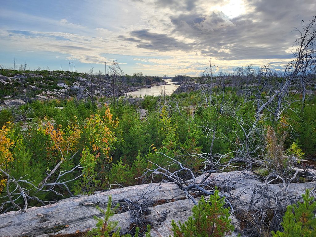
We’ve been monitoring a burn on Georgian Bay’s coastline in Ontario for more than six years as part of a compensatory evaluation. Almost immediately after a 2018 fire burned more than 112 square kilometres, we were on site assessing the recovery of vegetation and wildlife. The project continues today – but the technology has evolved. We have a new tool to help us better understand and quantify the relationship between a recovering habitat and the organisms that call it home. Remote sensing is gaining wide recognition for its supplementary role in monitoring natural resources.
What is remote sensing? It’s the collection of data and imagery using sensors that are mounted to drones, planes, or satellites.
The area where we have been monitoring, which includes lands belonging to the Henvey Inlet First Nation, is of particular interest because it was home to Jack Pine (Pinus banksiana). This tree species is the preferred habitat of the endangered Kirtland’s Warbler, a species that has a global population of roughly 5,000 individuals and are known from only two small Ontario breeding sites. Our team has been working to restore habitat for the Kirtland’s Warbler, so it was an exciting opportunity to study how Jack Pine regenerates – and exactly when, and if, it would become ideal Ontario habitat for returning warblers.
On-the-ground vegetation monitoring can be logistically and technically challenging, expensive, and at the end of it all, the final coverage of a study area may only be ±1%. To address some of these challenges, our team has been exploring opportunities to minimize ground survey time, increasing data collection coverage, and reduce overall costs – all without sacrificing data quality.
Our approach has been centered around remote sensing – particularly, the use of data collected from drones. We have been gaining expertise in the use of Structure from Motion (SfM), as well as aerial LiDAR.
Structure from Motion data is a 3D representation of the study area. It is prepared by flying the drone along transects over the study area, taking hundreds of overlapping photos along predefined intervals. Specialized software is then used to create the 3D model through triangulation of the images. This information allows us to map and quantify various height profiles of different vegetation classes (e.g., tall trees, low shrubs). We can then also review this data from the perspective of Ecological Land Classification (ELC) to map vegetation communities, such as treed rock barrens. This helps to remove some of the inherent surveyor subjectivity from interpretations. Understanding how a vegetation community is regenerating could help us understand the nuances of “ideal” habitat for the Kirtland’s Warbler.
We have used this technique experimentally on several projects to better understand its advantages and limitations. With vegetation monitoring work, where submeter accuracy of height profiles is critical, the SfM data is not ideal. To address this, we purchased a real-time kinematic (RTK) drone and paired it with a Light Detection and Ranging (LiDAR) sensor.
Drones capable of RTK (which provide on-the-spot correction of satellite errors) can provide centimeter-level positional accuracy. LiDAR sensors measure the height of surface features, such as treetops. It does this by blanketing the study area with pulses of light, which reflect back to the LiDAR sensor. Based on the time it takes each pulse to return to the sensor, heights are calculated, and a 3D model can be prepared. LiDAR data is also centimeter-level accuracy. Therefore, pairing these two systems provides highly accurate data capable of monitoring vegetation growth. LiDAR is also capable of creating 3D models of understory vegetation, such as shrub density under a tree canopy.
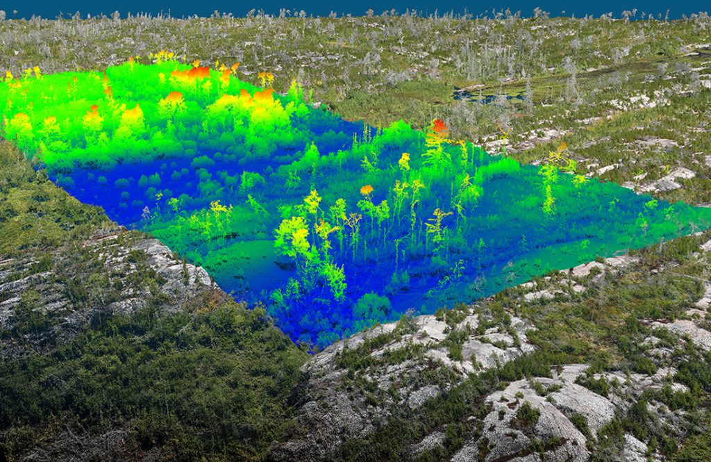
This type of data analysis in the field of ecology is relatively new and offers significant opportunities to reduce ground-survey requirements while providing up to 100% coverage of a study area. In 2024, we flew the RTK drone and LiDAR sensor of large subsections of the burn area and will be analyzing the data this winter. We are also exploring the opportunity to use artificial intelligence (AI) to help us understand what features are most attractive to a warbler in search of nesting habitat and, in turn, identify all potentially suitable areas within the study area.
In 2024, we were excited to find two pairs of Kirtland’s Warblers nesting in one small area of the burn site we were monitoring. This was a momentous discovery that could have significant future implications for the warbler’s Canadian breeding population.
Looking to the future, this ability to analyze vegetation to a much finer degree will make it easier to find the relationships between habitats and other species at risk. If you’re interested in learning how remote sensing technologies can help you manage your natural resources, contact us at pburke@geiconsultants.com and jleslie@geiconsultants.com.


